


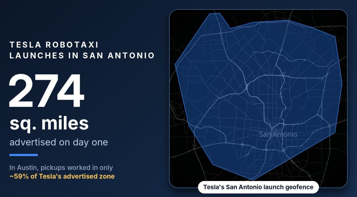
Tesla is launching its Robotaxi service in San Antonio, its eighth city, with a launch geofence covering about 274 square miles. That’s the biggest day-one map Tesla has ever posted, and more than four times the size of Waymo’s San Antonio service area.
But if Tesla’s recent maps are any guide, a big chunk of that area won’t be bookable. In Austin, an independent check found the Robotaxi app only accepted pickups and drop-offs in about 59% of the zone Tesla advertises.
A big map, and no cars spotted yet
Tesla’s official Robotaxi account made the announcement just after midnight local time: “Robotaxi available in San Antonio starting tomorrow, 5am.” It came with a map of the “launch geofence,” a large polygon that runs from Loop 1604 on the north side down to just south of downtown.
Robotaxi Tracker, which measures operator maps and logs fleet sightings, puts the zone at 274 square miles. That covers about 1.0 million residents (51% of the metro) and 721,000 jobs. San Antonio International Airport sits inside the polygon, but it isn’t served.
Waymo started driverless rides in San Antonio in February with more than 60 square miles and opened to all riders in October, airport trips included. Robotaxi Tracker currently lists Waymo’s San Antonio area at 59 square miles.
What Tesla didn’t say is how many cars will cover its 274 square miles. As of Monday morning, Robotaxi Tracker hadn’t logged a single Tesla Robotaxi in San Antonio.
The launch landed the same day Tesla expanded Austin again. The tracker now measures Tesla’s Austin zone at 443 square miles, up 178 square miles since mid-September.
The map isn’t the service
We’ve seen this movie. Last month, Tesla expanded its Houston geofence into the shape of a rocket, and within two days the creator of Robotaxi Tracker found the app refusing downtown pickups inside it.
Since then, Koby Pierce, who tracks Tesla’s service on X, has done the tedious work of checking city after city. He searched thousands of real addresses in the Robotaxi app on an emulator and mapped only the ones where Tesla allows a pickup or drop-off, then compared that with the map Tesla advertises. Here’s the share of Tesla’s advertised land area that actually works:
- Austin: about 59% (83% of residents)
- Miami: 61% (67% of residents)
- Orlando: about 70%
- Fort Worth: about 72%
- Houston: about 74%
- Dallas: 78% (89% of residents)
Austin is the one that matters. It’s Tesla’s flagship market, with 453 unsupervised vehicles in service according to Robotaxi Tracker. Yet about 41% of the advertised map Pierce tested, mostly on the east side of town, wouldn’t take a ride request. Pierce points to railroad crossings as a big factor in several cities, which lines up with the strange downtown routing we saw in Houston.
To be fair, Pierce says Waymo is next on his list, and he expects “they’re no better.” Robotaxi Tracker already had to trim Waymo’s Orlando area last month after finding the airport, inside Waymo’s published map, wasn’t selectable. We’ll look at those numbers when they’re out. But it doesn’t change what Tesla is doing with San Antonio today.
Author: Fred Lambert
Source: Electrek
Reviewed By: Editorial Team
