![]()
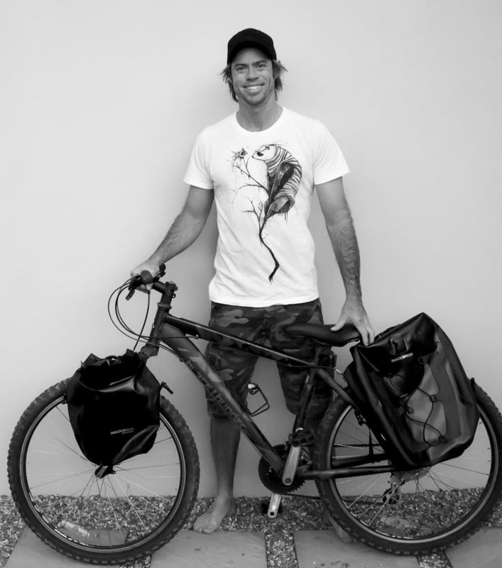
Australian photographer Ben Neale built an inflatable boat-plane to capture incredible aerial photos of remote areas of the Solomon Islands and the Great Barrier Reef off the coast of Queensland, Australia.
One would think that this is an incredibly dangerous way to fly, but he has previously also taken to the air with what looks like a giant fan attached to his back. It’s called a paramotor, something used for propelled paragliding.
![]()
“Fear doesn’t stop death; it stops life,” Neale tells PetaPixel. “Many [scary moments] … got my paraglider caught in the prop [propeller] while flying, lots of engine-out scenarios and emergency landings. Plenty of tree and water landings with full kit, turbulence collapsing the glider. It just comes with the territory with this kind of flying equipment.”
“Ideally [with the boat-plane], you must stay over the water [for emergency landings], although there is a story about a Greenpeace photographer that put one down into the rainforest canopy after an engine failure.
“Generally, you need to assume the engine will stop at any moment since it is not an aircraft-certified engine,” cautions the flying photographer.
Getting Into Aerial Photography
“After getting a taste for landscape photography when I finished school in New Zealand, I knew I would have to find a point of difference because even back then, there was an over-saturation of amazing landscape photographers,” explains Neale. “Peter Lik [Australian photographer who sold a print for $6.5 million in 2014], for example, opened his first gallery in my hometown of Cairns. I visited it when I was a teenager on my skateboard.”
![]()
Neale’s grandfather was flying microlights, and after one trip up with him, he knew aerial photography would be that difference.
“This was pre-drones,” says Neale. “It was ether helicopters which were cost prohibitive and hard to get into the most remote areas or choose from one of the many weird and wonderful flying contraptions in service at the time. I ended up settling on paragliders, you could travel with them, and if the engine stopped, you would have a chance at walking away unhurt [by gliding down to earth.]”
The Idea for a Boat-Plane
His family’s interest in sailing led the aviator-photographer to the flying boat as a platform. He had the opportunity to jump aboard some of their many trips out to the South Pacific Ocean.
![]()
“The limitations of the paramotor became evident very quickly in this environment, with few take-off options and a mortal fear of flying too far out to sea in case I had an engine failure that regularly plagued these machines,” Neale adds. “After hunting around for options, I found a listing for one of these aircraft and saw the potential to fill the gap between the land and sea as an aerial platform.”
He found a listing on a trading post in the USA in a hanger clean-out sale, and even the selling broker was not really sure what it was. It had numerous parts, and the photographer, without specialized training, figured out how to put it all together after toiling for full two months.

“[It] took three months to feel OK enough to give it a test flight,” says the living on the edge 37-year-old adventurer.
The test flight for the dinghy-plane was a nerve-wracking experience on Newell Beach in Queensland, Australia, in 2017. He ascended just a little, descended promptly again, and went up and down till he could build his confidence in the plane’s airworthiness. He was used to being high up in the air with the earlier motorized paraglider, and that experience certainly helped.
![]()
Neale has taken the boat-plane up to 6,000 feet above ground level in the following years — over a mile in the air on a contraption that he has admitted can “stop at any moment.”
The engine, for the technically inclined, is an 800cc 2-cylinder, two-stroke, water-cooled, meaning it is like a medium-powered motor-cycle engine. The plane weighs 250 kilograms (550 lbs) and can even carry a passenger.
![]()
“I used to take my wife up and get her to take a few images,” says the photographer. “However, she was never too excited about the idea!
“The longest flight was around 5 hours [with a custom extended fuel tank fitted in the hull.] This was running up the great barrier reef in Australia.
“There is a ballistic parachute built into the machine. You can deploy it, and it brings a chute out with a rocket. It will bring the whole craft down safely. This will only be effective over 300 ft, so high is safe. The danger zone is between 0 and 300ft.
“If it is just an engine failure, you can land like a hang glider. All my landings are with the engine just idling.”
![]()
Flying Over the Solomon Islands
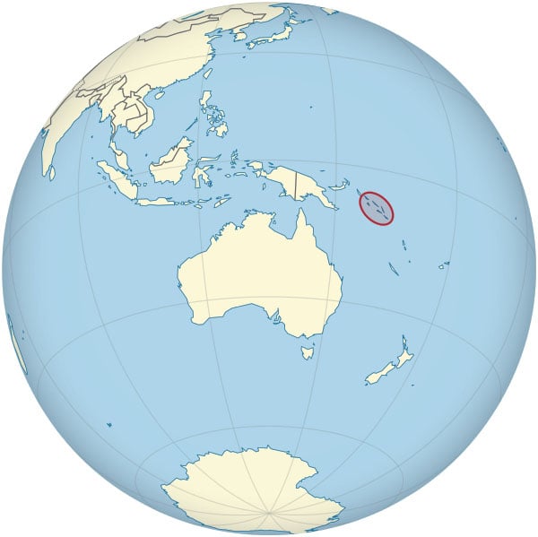
The Solomon Islands consist of six major islands and over 900 smaller islands in Oceania, to the east of Papua New Guinea and over 200 miles North East of the eastern seacoast (and Cairns, the hometown of Neale) of Australia.

Neale was lucky to get transportation with his mother’s partner on a sailboat to the Solomon Islands with the dinghy-plane after “lots of modifications.” However, they had terrible weather for almost a week.
When they arrived, the flying boat was put together and tethered to the back of the sailboat. Next came a storm on the second day of their arrival, and the boat-plane went to the bottom about 5 to 10 meters (16 to 33 feet) under the water. They used a rope and pully off the top of the sailboat’s mast to bring it back to the surface.
![]()
When they fished the boat-plane out, they flushed it with fresh water but lost the electrics and the instruments. However, it could still fly, and off went Neale on his adventure. He spent nine weeks in the Solomon Islands, capturing azure blue vistas of unadulterated seascapes, despite some mechanical failures with the plane.
“After we lost instruments, all the flying was just visual,” says Neale. “I did take a compass. Yes, it is pretty easy to navigate there, as you can follow the string of islands away and back home.”
![]()
“It was simultaneously a disaster and a success,” the photographer says. “It was plagued with mechanical issues for the entire nine weeks. We managed to limp through the expedition and get 90% of what we set out to cover.”
Neale has also flown and photographed from the dinghy-plane over the Great Barrier Reef off the coast of Queensland, Australia. The reef stretches over 1,400 miles and is the world’s biggest single structure made by living organisms.
![]()
Explorers in remote areas usually carry a satellite phone for emergencies. But Neale says it would be of no help at all.
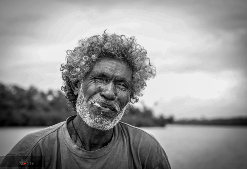
“There really isn’t anyone to call out in these remote regions,” says Neale. “I had a VHF [Very High Frequency] radio for comms [communications] back to the boat we sailed over on; however, after 10kms, it was out of range. The locals were tremendously helpful, though. I ran out of fuel once and got towed for 6 hours back to our sailboat [portrait of the person below]. We returned the favor with a full tank of fuel and a couple of stainless-steel machetes.”
Incidentally, the local who towed him back was named Kennedy after President John F. Kennedy! He grew up on Kennedy Island, where in August 1943, the crew of the patrol torpedo boat PT-109, commanded by then Lieutenant Kennedy, swam after their craft was rammed and sunk by the Japanese destroyer Amagiri in World War II.

![]()
The Cameras of Plane Photography
Neale currently uses the medium format Pentax 645Z, which he also shot with in the Great Barrier Reef.
In the Solomon Islands, he was on his earlier camera, a Nikon D800E DSLR with a Nikkor 24-70mm, f/2.8. And before that was a Canon 5D Mark II.
![]()
And there is the GoPro, the world’s most versatile camera, attached to the wing that continuously records a video of the plane in action with picturesque backgrounds.
“I generally sell and buy equipment yearly to keep up with very fast-moving technological advancements,” says Neale.

![]()
Resolution and dynamic range are critical to Neale as he wants the ability to make extra-large prints. He even stitches 3 to 4 images from the medium format Pentax 645Z to get the maximum resolution.
“I played around a bit with rez-up software but was never happy with the results, especially if there are fine details,” says the aerial photographer. “I’d comfortably print over 3 meters (10 feet) if it was a stitched image out of the Pentax.”
RAW is Neale’s preferred mode of shooting, whether on medium format or full-frame, and then he uses Photoshop to stitch multiple images into a single frame.
![]()
The Creation of Gallery Earth
Gallery Earth is Neale’s virtual gallery and website for offering prints for sale, with part of the profits going to either one of the organization’s partners or an NGO of the purchaser’s choice.
“I wanted to test the conventional business model for photography,” says Neale. “I was frustrated by intellectual property theft and the general hustle prevalent in the photography industry.
![]()
![]()
“I thought it would be great to be able just to give the work away and get paid through appreciation while supporting great NGOs that worked in areas of conservation. So far, it’s worked quite well. People inspired by the causes you support and the products you offer are happy to pay for them.
A print lab in Neale’s local area does an amazing job. He has worked very closely with them for quality control and has not found better prints than he has achieved with them.
![]()
![]()
![]()
Neal’s trips are usually half-funded from photo sale revenue and a half from working in land restoration and conservation. He primarily uses information from drones to plant trees and map ecosystems. However, he has never done any aerial photography with a drone.
He generally shoots oceanic landscapes from the boat-plane and the odd whale when he has been lucky enough to spot one. He likes equally photographing landscapes or animals.
“To sit and watch an animal undisturbed is a pretty special thing,” reflects Neale.
Land-based animals are affected by the noise of the aircraft but not so with aquatic animals.
![]()
![]()
Photographic Beginnings
Neale has been doing photography for the last 15 years. A trip around New Zealand in a van with a cheap point-and-shoot originally ignited his passion for photography.
“The New Zealand landscape has a way of deceiving you into thinking you are a professional photographer prematurely,” jokes Neale.
![]()
After finishing school, he found himself in Nepal, situated in the Himalayas between India and China. He got a paragliding license, setting him on 15 years of aerial photographic adventures and misadventures.
“After numerous tree landings and losing my entire camera kit in the ocean on more than one occasion, I developed a system of a head-mounted DSLR camera with a shutter switch in my mouth,” recalls Neale. “Hands-free and more confident with the paraglider, I was able to adapt the paramotor power aspect of the aircraft and start traveling to all the remote regions I had always dreamed of.”
![]()
![]()
Crying for Conservation
“My last trip was to Borneo when everything changed for me. I cried on the plane when I flew out of Kalimantan. Looking out of the window, [were] horizon to horizon of palm oil plantations shrouded at the limits of visibility by the smoke from the burning bordering rainforest.
“There is a stark juxtaposition there between climaxed tropical rainforest with biodiversity seen nowhere else on earth and the ecological desert that’s the exponentially expanding palm oil plantations. I then shifted to not just photography but trying to get actual trees in the ground using what I had learned while flying. Now I work alongside Climate Force leveraging UAV technologies to restore rainforest ecosystems at scale.”
![]()
Neale wishes his photography of Mother Earth to make a connection. His day job is also in conservation and land management with UAV systems.
“I try to connect the audience to the scale and beauty of the vast landscapes of the earth and its artistry only appreciated from the air,” he says. “I do this to drive conservation.”
![]()
The Future
Drone technology is becoming undeniably superior for aerial photography from what it was in 2017 when Neale built the boat-plane.
“We sat for four weeks in a tent in Namibia, waiting for the weather to be suitable to fly the paraglider for one shot,” says Neale. “I could now sit in a car’s air-conditioning and achieve a similar result in almost any weather conditions with a UAV. Some UAV systems now can comfortably carry [the weight of] Sony’s A7 [full frame] range of mirrorless [cameras.] These advantages can’t be ignored. It’s sad because the romance of the adventure was what always drew me to the profession.
![]()
“To imagine the potential of a particular shot in your mind, spend the next six months meticulously planning for it, then risk everything to get it, that was the magic.
“I focus now entirely on conservation. I use my photography to support the NGOs I’m inspired by and my aerial experiences to leverage UAV systems for planting mapping and photographing rainforest ecosystems.
“I am privileged enough to live in the oldest rainforest on Earth (the Daintree), and to ignore its plight is impossible after what I have witnessed so many times abroad. The responsibility to restore what’s on my doorstep is too heavy to ignore, so this naturally is where I focus my efforts.”
About the author: Phil Mistry is a photographer and teacher based in Atlanta, GA. He started one of the first digital camera classes in New York City at The International Center of Photography in the 90s. He was the director and teacher for Sony/Popular Photography magazine’s Digital Days Workshops. You can reach him here.
Image credits: All photos courtesy of Ben Neale
Author: Phil Mistry
Source: Petapixel


