Google Maps is one of the company’s most successful products, and for good reason. The app is useful for more than just getting around, but also for seeing nearby businesses and attractions, as well as live traffic. Now, Google Maps is starting to show railroad crossings too.
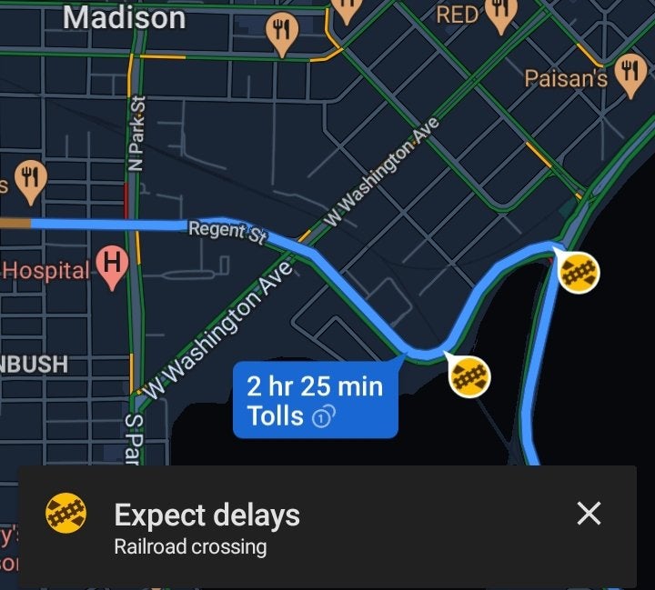
During navigation, users have noticed that Google Maps is starting to show railroad crossings along your route. As you approach a railroad crossing on your selected route, a new banner may pop up saying “Expect Delays.”
Google hasn’t officially announced this new feature, but AutoEvolution found that it’s been gradually rolling out for a little while now. We’ve not seen the feature live on our devices just yet, though.
In the example shared on Reddit, we can see the notification appearing in Madison, Wisconsin where two different railroad crossings affect the same route. It’s unclear if these alerts are triggered by users reporting the crossing as being active, or if it’s just triggered by crossings that often cause delays. In any case, this is a potentially useful tool for those unfamiliar with an area.
Waze, notably, rolled out this functionality back in August in an effort to help cut down on accidents related to crossings, especially those that are unmarked. Likely, Google is pulling from that data to offer the same feature in Maps.

More on Google Maps:
- Google Maps dark theme for Android officially rolling out
- You can now pay for parking directly from the Google Maps app in more cities
- Google Maps appears to be testing a new route option UI
Author: Ben Schoon
Source: 9TO5Google


