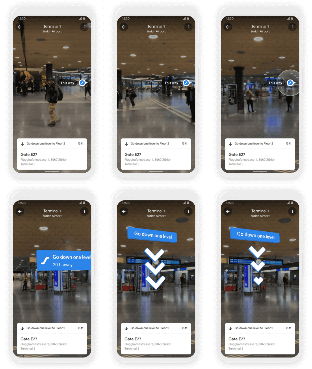
Google has announced that Maps will now offer indoor AR directions and can even favor eco-friendly navigation when pointing you from location to location.
Announced in a blog post, the new indoor AR directions expanded upon the Live View features that were introduced to Google Maps previously. This feature won’t be available everywhere just yet, but will work in selected locations such as airports, malls, and train/bus stations to help you find out exactly where you’re headed.
If you’re catching a plane or train, Live View can help you find the nearest elevator and escalators, your gate, platform, baggage claim, check-in counters, ticket office, restrooms, ATMs and more. Arrows and accompanying directions will point you the right way.

AR directions in indoor locations will not be available everywhere just yet, but you can use it today in a “number of malls” in Chicago, Long Island, LA, Newark, San Francisco, San Jose, and Seattle. Google says that it will expand to more shopping locations in the coming months. While Tokyo and Zurich are the first areas to gain transit and airport Live View directions.
And if you need to pick something up from the mall, use Live View to see what floor a store is on and how to get there so you can get in and out in a snap. Indoor Live View is live now on Android and iOS in a number of malls in Chicago, Long Island, Los Angeles, Newark, San Francisco, San Jose, and Seattle. It starts rolling out in the coming months in select airports, malls, and transit stations in Tokyo and Zurich, with more cities on the way.
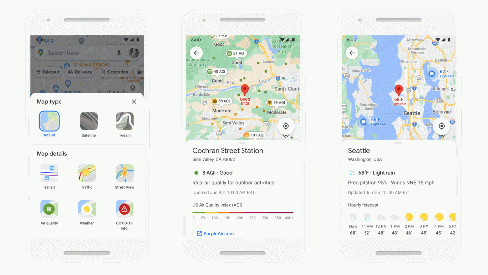
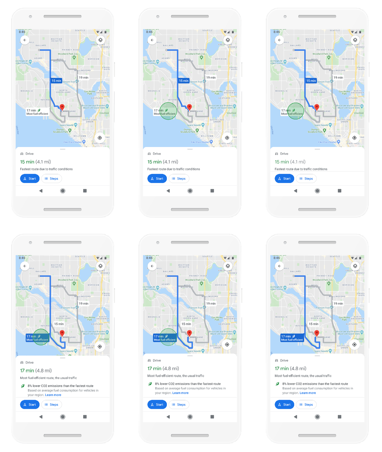
Another core component coming to Google Maps alongside indoor AR directions is that of eco-friendly route calibration. When a route is recommended, you’ll now be shown local weather and air-quality data. Maps will suggest more fuel-efficient and, therefore, eco-friendly routes when travelling by car.

Maps will actually default to the most eco-friendly route if these directions provide the same ETA. You can change or adjust your preferences within Settings should you prefer this to be disabled or tweaked. Unlike Google Maps indoor AR Live View directions, eco-friendly re-routing is launching “later this year” in the US with more countries coming soon. This is part of the firm’s commitments to help 1 billion daily users reduce their overall carbon footprint across the globe.
Soon, Google Maps will default to the route with the lowest carbon footprint when it has approximately the same ETA as the fastest route. In cases where the eco-friendly route could significantly increase your ETA, we’ll let you compare the relative CO2 impact between routes so you can choose. Always want the fastest route? That’s OK too — simply adjust your preferences in Settings. Eco-friendly routes launch in the U.S. on Android and iOS later this year, with a global expansion on the way.
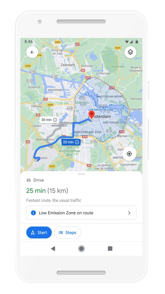
Another notable is that of low-emission zone recognition within Google Maps. Many global regions include these areas to prevent or actively curb vehicle usage to help reduce emissions and localized CO2 levels. Google Maps will soon be able to inform you if a proposed route heads through a “low emission” zone and suggest an alternative route if you vehicle is not suitable. This is launching in June in Germany, the Netherlands, France, Spain, and the UK, with more countries coming soon.
From Amsterdam to Jakarta, cities around the world have established low emission zones — areas that restrict polluting vehicles like certain diesel cars or cars with specific emissions stickers — to help keep the air clean. To support these efforts, we’re working on alerts to help drivers better understand when they’ll be navigating through one of these zones.
You can quickly know if your vehicle is allowed in the area, choose an alternative mode of transportation, or take another route. Low emission zone alerts launch this June in Germany, the Netherlands, France, Spain, and the UK on Android and iOS, with more countries coming soon.
Alongside indoor AR directions and more eco-friendly routing, Google Maps will make it even easier to plan curbside grocery collection/pickups. The COVID-19 pandemic has seen a rise in the popularity of “contact free” delivery, which is why Maps is adding a limited pilot program for curbside collection from selected retailers.
Business profiles on Maps can add shopping and delivery information with delivery providers and pickup information, which will make it easier to decipher with a cursory glance or search. This is coming initially to Instacart and Albertsons stores in the US, with further expansions to other partners soon. Google has also teamed up with Fred Meyer to run a pilot scheme at selected stores in Portland, Oregon, that will streamline grocery collection.
After placing an order for pickup within a stores dedicated app, you will be able to add it Maps. You’ll then get a notification when it’s time to leave, and this will in turn inform the store of your arrival time. Your ETA is constantly updated based upon driving conditions or transit, and this should help retailers prepare or prioritize your order so that contact-free collection is a breeze.
- [Update: Now available] Google Maps dark theme for Android officially announced
- Google Maps getting a more powerful road editing tool on the web
- Google Maps starts showing railroad crossing alerts during navigation
Author: Damien Wilde
Source: 9TO5Google


